Mt. Mashu Trail
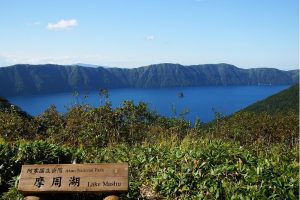
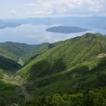
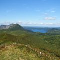
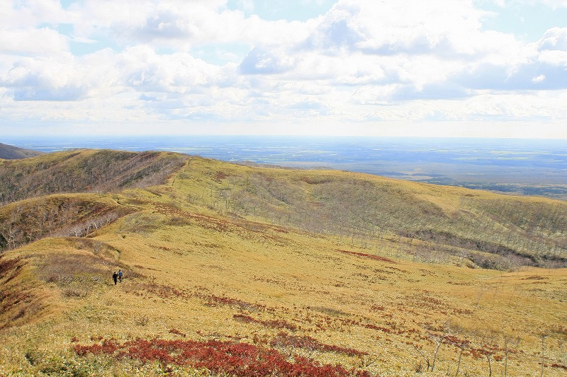
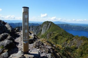
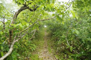
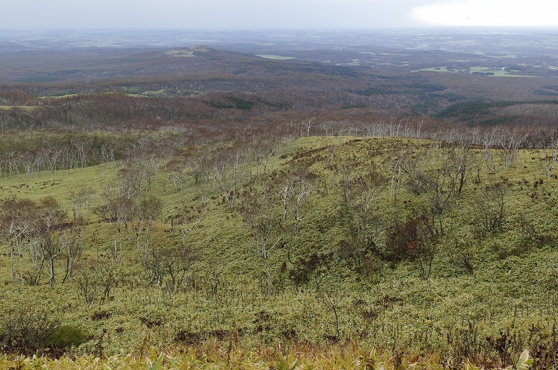
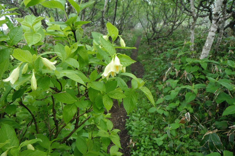
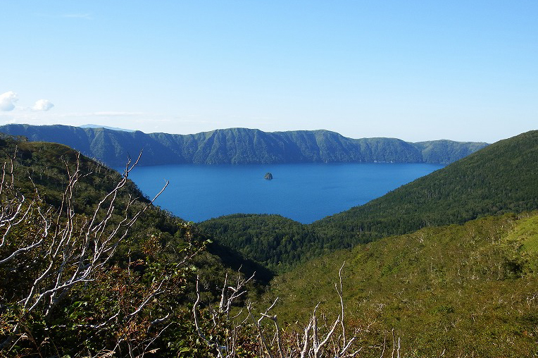
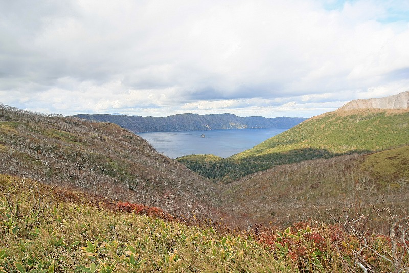
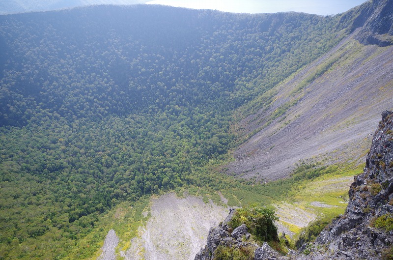
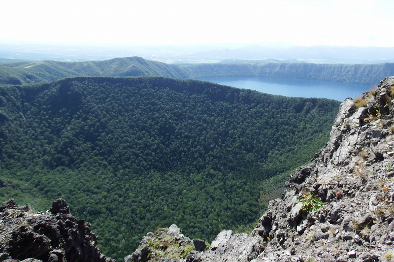
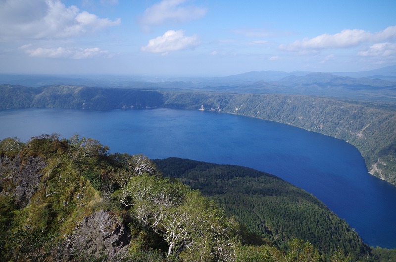
Entrance of the trail is from one of the famous sightseeing spot “Mashu Viewpoint 1”. You will start walking after writing your name in the climbing list. The trail is set along the ridge of the Mashu Caldera. The trail descends slowly at first 30min and ascend slowly after 30min. Walk watching above your head as trees covers the trail. After walking to a certain extent, you will see Senkon Field, Mt.Nishibetsu, Mt. Mashu and etc. It is also good to see a changing shape of Lake Mashu, moving the leke on the left hand side. You can then see a different appearance of the lake when arriving at the place called “Fusho Heigen”. After passing a junction towards Mt. Nishibetsu and Mt. Mashu, last 300m of the trail becomes steep. You will see Lake Mashu, exploded crater, Mt. Nishibetsu, Mt. Mokoto, Mt.Shari and etc at the peak of the Mt. Mashu.
Mt,Mashu Map inside(pdf)
Mt,Mashu Map ouside(pdf)
Mt,Mashu Map English(pdf)
Distance about 14.4 ㎞ (One Way 7.2 km)
Uphill about 2 hr 30 min / Downhill about 2 hours
Mt.Mashu summit 857m
Vertical dorp about 311m
Characteristics of Mt. Mashu
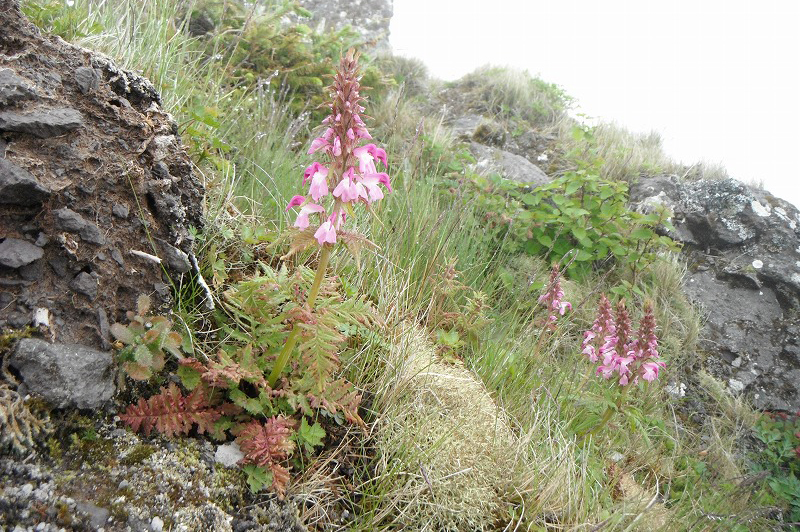
Mt. Mashu is called “Kamui-nupiri” in Ainu, meaning God Mountain prayed by Ainu People. Kamui-nupuri is Stratovolcano forned by the eruption 1000 years ago. Size of the exploded crater is 1.5km*1.25km and volcanic activity is not active recently. Low and high tree are seen until 5th station. Alpine plants can be seen at the peak of the moutain.
About Climbing
Maintenance of the trail is planed twice a year in July and October, however, if the weather is not good in scheduled date, maintenance is delayed. Please watch out mice and etc. Also, very unconfortably flies and horseflies appears in the climbing season in Summer, and they sometimes bite through your clothes. Wearing long sleeb clothes and pants is recommended and prepare for insects. There is no toilet facility on the way. Please enjoy trekking in confortable hiking plan.
Photo Gallery
Access
Map Code 613 781 311
Access(Airport, JR & Bus)
From Kawayu Eco-Museum Center
Kawayu Eco-Museum Center ⇒ Seasonal Ecopassport ⇒ Mashu Viewpoint 1
From Kushiro/Kushiro Airport
Kushiro Airport ⇒ Kushiro Airport Shuttle Bus(About 45min) ⇒ JR Kushiro Station ⇒ JR Senmou Line(Abuot 1hour40min) ⇒ JR Mashu Station ⇒ Seasonal Ecopassport ⇒ Mashu Viewpoint 1
From Abashiri/Memanbetsu Airport
Memanbetsu Airport ⇒ Memanbetsu Airport Shuttle Bus(About 30min) ⇒ JR Abashiri Station ⇒ JR Senmou Line(About 45min) ⇒ JR Shiretoko Shari Station ⇒ JR Senmou Line(About 45min) ⇒ JR Mashu Station ⇒ Seasonal Ecopassport ⇒ Mashu Viewpoint 1
From Nakashibetsu Airport
Nakashibetsu Airport ⇒ Nakashibetsu Airport Shuttle Bus(About 30min) ⇒ Nakashibetsu Bus Terminal ⇒ Akan Bus(About 1hour30min) ⇒ JR Shibecha Station ⇒ JR Senmou Line(About 30min) ⇒ JR Mashu Station ⇒ Seasonal Ecopassport ⇒ Mashu Viewpoint 1
*No Public transportation to the entrance of Mt. Ponpon Trail. Please use taxi from JR Mashu station. JR Mashu Station is the nearest Station, but Taxi is not always waiting due to small station. Please book the guide tour or taxi before you come.
Access (by car)
MAPCODE
613 781 311
From Kawayu Eco-Museum Center
Kawayu Eco-Museum Center ⇒ 52 Line(About 30min) ⇒ Mashu Viewpoint 1
From Kushiro/Kushiro Airport
Kushiro City ⇒ 391 Line(About 2hour 30min) ⇒ Mashu Viewpoint 1
Kushiro Airport ⇒ 53 Line(About 2hour) ⇒ Mashu Viewpoint 1
From Abashiri/Memanbetsu Airport
Abashiri City ⇒ 244Line・391Line(About 1hour30min) ⇒ Mashu Viewpoint 1
Memanbetsu Airport ⇒ 243Line・52Line(About 1hour30min) ⇒ Mashu Viewpoint 1
From Nakashibetsu Airport
Nakashibetsu Airport ⇒ 13Line・243Line・391Line(About 1hour30min) ⇒ Mashu Viewpoint 1