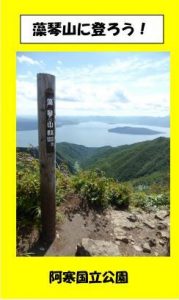
Mt. Mokoto Trail
Mokotoyama Trail
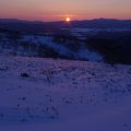
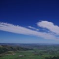
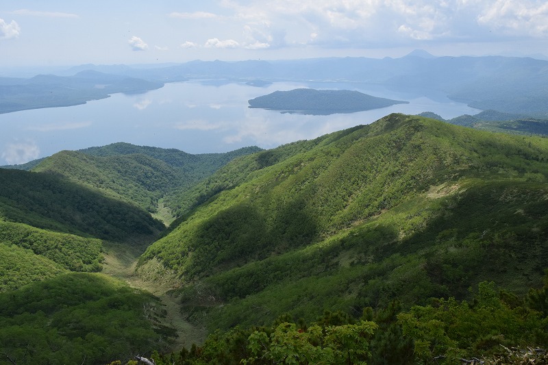
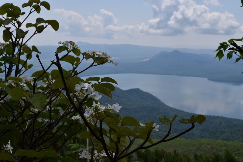
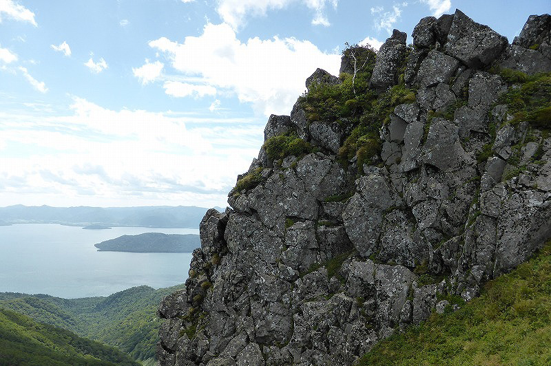
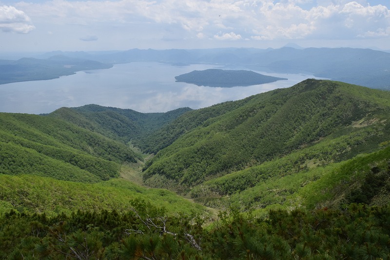
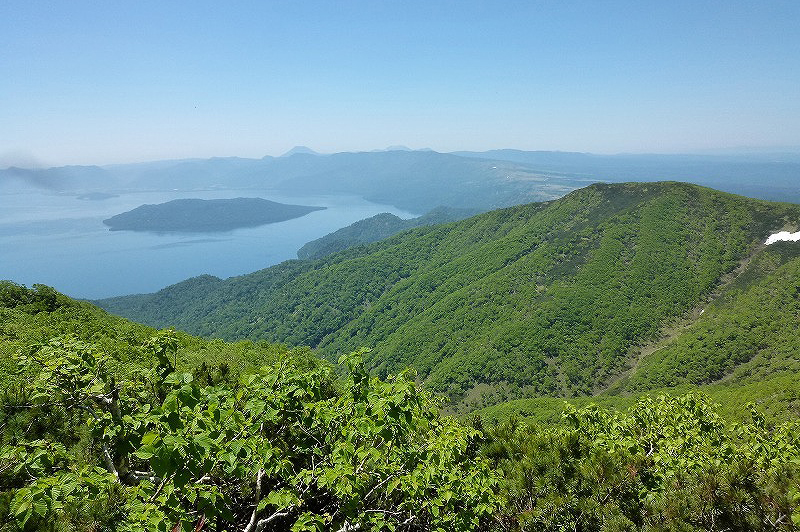
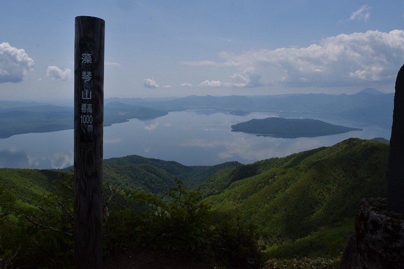
You can see the sign of Mt. Mokoto trail entrance on the 102 line and follow the sign. You can reach the begging of Mt. Mokoto Trail which is from a mountain hut called Ginreisou, set at the 8th station of the moutain. Soft Water called Ginreisui springs out in front of the mountain hut. It takes only about 30min oneway to the top of the mountain, so even children can enjoy hiking. You can overlook the Ohotsk sea and Lake Kussharo from the 9th station.
Skyline Trail & Long Trail course
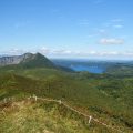
You can choose trails to go around Highland Koshimizu and Koshimizu campsite from the mountain hut Ginreisou. This is new trail set in 2010. You can enjoy climbing Mt. Mokoto looking a beautiful scenery.
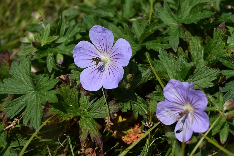
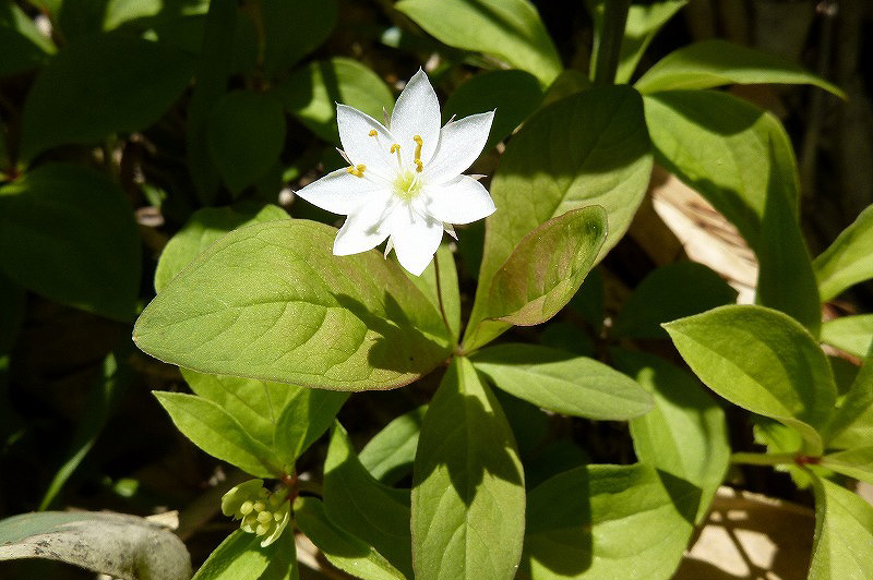
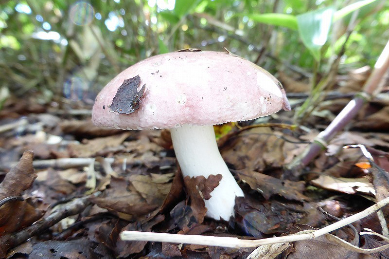
You may watch wild flowers and animals like Chipmunk along the trail. The moutain trail is open on Sunday of the mid-June every year and many people are enjoying climbing.
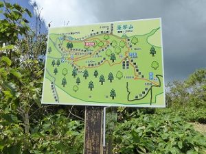
Selfguide map inside(pdf)
Selfguide English map outside(pdf)
Selfguide map outside(pdf)
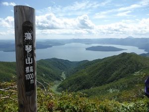
Mt.Mokoto Summit 1000m
Skyline Traill(Highland Koshimizu 725) Distance about 2 km / Time Uphill about 60 min / Downhill about 45 min / Vertical drop about 275 m
Mountian Trekking Traill(Ginreisui) Distance about 1.16 km / Time Uphill about 30 min / Downhill about 20 min / Vertical drop about 200 m
Characteristics of Mt.Mokoto
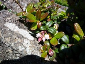
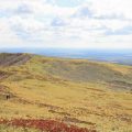
Mt.Mokoto is the highest moutain of the Kussharo Caldera ranges which is middle class elevated moutain in Akan National Park. This is the moutain located in Subalpine area and Russian rock birch is grown around the summit. 4 different plant community, hairyflower, Frasera, thistle and stone pine-Lingonberry is recognised.
About Climbing
Because there are newly set routes, please becareful of Mite if Sasa is grown much. Toilet is set at Camsite and Koshimizu Highland, hoever, it is closed except summer season. Please check if the facilities are open before you go out. The rope is stretched along the trail to protect plants by the ministory of the Environment. Please enjoy climbing the mountain following the rules.
Photo Gallery
Access
Access(Airport, JR & Bus)
From Kawayu Eco-Museun Center
No Public transportation from Kawayu Eco-Museum Center
From Kushiro/Kushiro Airport
Kushiro Airport ⇒ Kushiro Airport Shuttle Bus(About 45min) ⇒ JR Kushiro Station ⇒ JR Senmou Line(About 1hr40min) ⇒ JR Kawayu Onsen Station ⇒ Akan Bus(About 10min) ⇒ Kawayu Onsen
From Abashiri/Memanbetsu Airport
Memanbetsu Airport ⇒ Memanbetsu Airport Shuttle Bus(About 30min) ⇒ JR Abashiri Station ⇒ JR Senmou Line(About 45min ⇒ JR Shiretoko Shari stationJR Senmou Line(About 45min) ⇒ JR Kawayu Onsen Station ⇒ Akan Bus(About 10min) ⇒ Kawayu Onsen
From Nakashibetsu Airport
Nakashibetsu Airport ⇒ Nakashibetsu Airport Shuttle Bus(About 30min) ⇒ Nakashibetsu Bus turminal ⇒ Akan Bus(About 1hour30min) ⇒ JR Shibecha Station ⇒ JR Senmou Line(About 30min) ⇒ JR Kawayu Onsen StationAkan Bus(About 10min) ⇒ Kawayu Onsen
*No Public transportation to the entrance of Mt. Mokoto Trail. Please use taxi from Kawayu Onsen or station. JR Kawayu Onsen Station is the nearest Station, but Taxi is not always waiting due to small station. Please book the guide tour or taxi before you come.
Access (by car)
Mapcode
638 447 146
From Kawayu Eco-Museum Center
Kawayu Eco-Museum Center ⇒ 391 Line・102Line(About 20min) ⇒ Mokoto Pass
From Kushiro/Kushiro Airport
Kushiro City ⇒ 391 Line・102Line(About 2hours45min) ⇒ Mokoto Pass
Kuhsiro Airport ⇒ 53Line・102Line(About 2hours15min) ⇒ Mokoto Pass
From Abashiri/Memanbetsu Airport
Abashiri City ⇒ 244 Line・102 Line(About 1hour30min) ⇒ Mokoto Pass
Memanbetsu Airport ⇒ 334Line・102Line(About 1hour 30min) ⇒ Mokoto Pass
From Nakashibetsu
Nakashibetsu Airport ⇒ 13 Line・243 Line・391 Line・102 Line(About 1hour45min) ⇒ Mokoto Pass